Cartography, as a discipline, relies heavily on standardized symbology. Geographic Information Systems (GIS), frequently utilized by organizations such as the US Geological Survey (USGS), necessitate a clear understanding of these symbols. A critical element in map reading is the map north symbol, a visual representation indicating cardinal direction. Failure to properly interpret the map north symbol can lead to errors in navigation and spatial analysis, regardless of the software tool being used.
In an age dominated by GPS and digital navigation, the foundational skill of map reading can often be overlooked. Yet, the ability to interpret a map remains an invaluable asset, offering a deeper understanding of our surroundings and fostering self-reliance in unfamiliar territories.
The Enduring Importance of Map Reading
Map reading transcends mere direction-finding; it cultivates spatial reasoning, enhances situational awareness, and empowers individuals to make informed decisions based on environmental cues.
Whether navigating a bustling city or traversing a remote wilderness, the capacity to extract meaningful information from a map is a skill that can prove both practical and life-saving.
The North Arrow: A Guiding Star
At the heart of every map lies a seemingly simple, yet profoundly important symbol: the North Arrow. This unassuming indicator serves as the cornerstone of map orientation, providing the essential reference point for aligning the map with the real world.
Without a clear understanding of the North Arrow, the intricate details of a map become a jumbled mess of lines and symbols, devoid of meaning and practical value.
Unveiling the Mysteries of the Map North Symbol
This article aims to demystify the North symbol and unlock its full potential as a navigational tool. We will explore the different types of "north" represented on maps, delve into the concept of magnetic declination, and provide practical guidance on how to use the North Arrow effectively in various scenarios.
By the end of this guide, you will possess a comprehensive understanding of the map North symbol, empowering you to navigate with confidence and extract maximum value from any map you encounter.
Decoding the Basics: North Arrow and Compass Rose
While understanding the significance of North is paramount, grasping how it’s represented visually is equally vital for effective map reading. Two key elements typically fulfill this role: the North Arrow and the Compass Rose.
Let’s explore these foundational components, unraveling their functions and highlighting their historical context within the world of cartography.
The North Arrow: Your Key to Direction
At its core, the North Arrow serves a straightforward, yet indispensable function: it indicates the direction of north on the map. This seemingly simple symbol acts as the fundamental reference point for orienting the map and understanding spatial relationships.
By aligning the North Arrow with the actual direction of north (using a compass or other navigational tools), you can accurately interpret the map’s representation of the surrounding terrain. This foundational step unlocks the map’s ability to guide you effectively.
Styles and Variations
The North Arrow isn’t a monolithic symbol; it manifests in diverse styles and variations depending on the map’s purpose, scale, and design aesthetic. Some North Arrows are simple lines with an arrowhead pointing north, while others are more elaborate, incorporating intricate designs or compass-like features.
You might encounter North Arrows that indicate True North, Magnetic North, or Grid North – a distinction we’ll explore in greater depth later.
Regardless of the specific style, the fundamental purpose remains the same: to provide a clear visual reference for the direction of north. Familiarizing yourself with the different styles will enhance your ability to quickly locate and interpret this crucial symbol on any map you encounter.
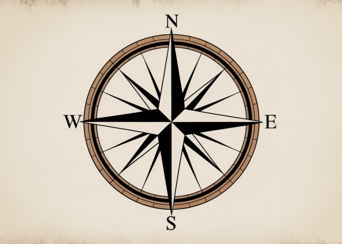
Unveiling the Compass Rose: More Than Just Decoration
The Compass Rose, often depicted as a circular diagram with radiating points, is another traditional element used to indicate direction on maps. While sometimes perceived as merely decorative, the Compass Rose holds significant historical and practical value.
Historical Significance
The Compass Rose has a rich history, dating back to the early days of navigation. It served as a vital tool for sailors, helping them determine direction and plot courses across vast oceans. The points of the Compass Rose traditionally represented the directions of winds, reflecting the importance of wind patterns in maritime navigation.
Visual Representation of Cardinal Directions
The Compass Rose visually represents the cardinal directions (North, South, East, West) and the intercardinal directions (Northeast, Southeast, Southwest, Northwest). These directions are typically marked with their corresponding abbreviations (N, S, E, W, NE, SE, SW, NW) around the circumference of the rose.
This visual representation provides a quick and intuitive way to understand the relationship between different directions, making it easier to orient yourself and plan your route.
North Arrow vs. Compass Rose: A Comparative Look
While both the North Arrow and the Compass Rose serve to indicate direction, they differ in their functionality and application. The North Arrow primarily functions as a single reference point for north, while the Compass Rose provides a more comprehensive visual representation of all cardinal and intercardinal directions.
The North Arrow is generally more prevalent on modern maps due to its simplicity and directness. The Compass Rose, on the other hand, is often found on older maps or maps with a historical or decorative emphasis.
In essence, the North Arrow offers a concise and unambiguous indication of north, while the Compass Rose provides a broader directional context. Both symbols, however, contribute to a map’s overall usability and interpretability.
The North Trifecta: True, Magnetic, and Grid North Explained
The journey of understanding direction on a map takes a fascinating turn when we realize that "north" isn’t a singular, fixed point. In reality, there are three distinct "norths" that play crucial roles in mapping and navigation: True North, Magnetic North, and Grid North.
Comprehending the nuances of each and their interrelationships is vital for accurate map reading and effective navigation, regardless of whether you’re an experienced cartographer or a weekend hiker.
Differentiating True North, Magnetic North, and Grid North
The existence of three different "norths" might seem perplexing at first, but each serves a specific purpose tied to the complexities of the Earth’s geography, magnetic field, and map projections. The critical difference lies in what each "north" uses as its reference point.
True North points to the geographic North Pole, Magnetic North aligns with the Earth’s magnetic field, and Grid North is a cartographical construct specific to a map’s projection.
Failing to account for these differences can lead to significant errors in navigation, potentially resulting in being off-course. Recognizing these variations allows you to navigate with precision.
True North: The Geographic North Pole
True North, also known as geographic north, is the most fundamental of the three. It represents the actual northernmost point on the Earth’s axis of rotation. This is the fixed point upon which all geographic directions are based.
True North serves as the ultimate reference point for mapmakers. All lines of longitude converge at True North. This makes it an unambiguous and constant reference for direction.
Magnetic North: The Ever-Shifting Magnetic Pull
Magnetic North is defined by the Earth’s magnetic field. It’s the point toward which a compass needle will point, assuming there are no local magnetic disturbances.
Unlike True North, Magnetic North isn’t a fixed location. The Earth’s magnetic field is constantly shifting, causing Magnetic North to migrate over time. This movement affects compass readings.
Understanding Magnetic Declination
The angular difference between True North and Magnetic North at any given location is called magnetic declination. This declination can be east or west, indicating the direction Magnetic North is offset from True North.
Magnetic declination is essential to consider for accurate navigation. Without correcting for declination, compass bearings will be inaccurate, potentially leading to errors in navigation.
Grid North: A Coordinate System Perspective
Grid North is a cartographic reference. It represents the direction northwards along the grid lines of a map projection. It is often used in conjunction with coordinate systems.
Unlike True North, which is a fixed point, Grid North varies depending on the specific map projection used. It’s designed to minimize distortion in specific regions.
Grid North and Map Projections
Map projections inevitably introduce some degree of distortion when representing the Earth’s curved surface on a flat plane. Grid North is often slightly offset from True North to minimize this distortion within the area of the map.
For example, the Universal Transverse Mercator (UTM) system uses Grid North. This minimizes distortion for specific zones around the globe.
Understanding Declination: Correcting for Magnetic Variation
Declination is the angle between True North and Magnetic North. It is a critical factor in accurate navigation using a compass and map. Declination values vary depending on your location on Earth and also change over time.
To navigate accurately, you must adjust your compass bearings to account for declination. This ensures that your intended direction aligns with True North as represented on the map.
Calculating and Correcting for Declination
Declination information is typically provided on topographic maps, often within the map’s legend. This information usually includes the declination angle. It also includes the year the declination was measured and the annual rate of change.
You can use online tools or consult resources such as the U.S. Geological Survey (USGS) to find declination information for a specific location. Remember to update the declination value based on the map’s date and the annual change. This ensures the most accurate correction.
True North, Magnetic North, and Grid North are not just abstract concepts; they are fundamental to the creation and use of maps. Understanding these "norths" allows us to appreciate how cartographers translate the three-dimensional world onto a two-dimensional surface, and how we, in turn, can use those maps to navigate our surroundings effectively. Let’s explore how the North symbol is applied in real-world scenarios, from its vital role in cartography to its practical applications in navigation.
North in Action: Cartography, Navigation, and Practical Applications
The North symbol isn’t just an aesthetic addition to a map; it’s a functional element deeply intertwined with the principles of cartography and the practice of navigation.
Its design, placement, and integration with other map elements directly impact a map’s usability and accuracy.
Let’s examine how cartographers use the North symbol and how it assists in navigation, offering practical examples for various users.
The Role of Cartography in Representing North
Cartography, the art and science of mapmaking, relies heavily on accurately representing direction.
The north symbol isn’t just placed on a map; its design and orientation are carefully considered based on several factors, including the map projection, scale, and intended use.
Design Considerations
The design of the North symbol itself can vary significantly.
Some maps use a simple arrow, while others incorporate more elaborate designs like a compass rose or a combination of arrows indicating True North, Magnetic North, and Grid North.
The choice of design often depends on the map’s purpose and the level of detail it aims to convey.
Placement and Orientation
The placement of the North symbol is equally crucial.
It should be clearly visible and easily distinguishable from other map symbols.
Its orientation must accurately reflect the relationship between True North, Magnetic North, and Grid North for the specific location covered by the map.
Cartographers often include a declination diagram to illustrate this relationship, allowing users to correct for magnetic variation.
Map Projections and North
Different map projections distort the Earth’s surface in different ways.
Some projections preserve angles (conformal), while others preserve area (equal-area).
The choice of projection affects how North is represented on the map.
For example, on a Mercator projection, lines of longitude are straight and parallel, and North is always "up" on the map.
However, this projection significantly distorts areas at higher latitudes.
Navigation: Using the North Symbol for Orientation and Wayfinding
The North symbol is a fundamental tool for orientation and wayfinding.
By aligning a map with the North symbol to the corresponding direction on the ground (using a compass or other means), users can establish their location and plan their route.
Orientation with a Compass
The most common method of using the North symbol for orientation involves a compass.
By knowing the declination (the angle between True North and Magnetic North), users can adjust their compass readings to accurately align the map with True North.
This allows them to identify landmarks, determine their position, and plan their route with confidence.
Wayfinding and Route Planning
Once oriented, the North symbol becomes essential for wayfinding.
By referencing the map and the surrounding terrain, users can identify their current location, determine the direction of their destination, and plan a route that avoids obstacles and follows the desired path.
Practical Significance for Users (e.g., Hikers)
The knowledge of North symbols translates into practical benefits for various users, especially those who engage in outdoor activities.
Hikers, for example, rely heavily on maps and compasses to navigate trails and reach their destinations safely.
Real-World Applications for Hikers
Imagine a hiker venturing into unfamiliar terrain.
By understanding the North symbol and using a compass to orient the map, they can:
- Determine their precise location on the map.
- Identify the direction of their destination (e.g., a mountain peak or a campsite).
- Choose the best route, considering terrain features and potential hazards.
- Avoid getting lost by regularly checking their position and direction.
Beyond Hiking
The applications extend beyond hiking.
Anyone who uses maps for navigation can benefit from understanding the North symbol.
This includes:
- Sailors: Charting courses and avoiding hazards at sea.
- Pilots: Navigating aircraft and staying on course.
- Urban explorers: Finding their way through complex cityscapes.
- Search and rescue teams: Locating missing persons in remote areas.
Navigational Tools: Integrating the North Symbol with Other Technologies
While traditional compass and map skills remain valuable, modern technology has revolutionized navigation.
Many navigational tools, such as GPS devices and smartphone apps, integrate the North symbol and related concepts to provide users with accurate and user-friendly navigation assistance.
GPS and Digital Maps
GPS devices and digital maps automatically calculate the user’s location, direction, and declination, eliminating the need for manual calculations.
However, understanding the underlying principles of the North symbol remains crucial for interpreting the information provided by these devices and for troubleshooting potential errors.
Augmented Reality
Augmented reality (AR) apps can overlay digital information onto the real world, providing users with a seamless navigation experience.
These apps often use the North symbol to orient the user and display directional information directly on their smartphone screen.
The Enduring Importance of Understanding North
Despite technological advancements, the fundamental principles of the North symbol remain relevant.
Understanding True North, Magnetic North, and Grid North, and how they are represented on maps, empowers users to navigate effectively and confidently, regardless of the tools they use.
Frequently Asked Questions About Map North Symbols
Here are some common questions about understanding and using the map north symbol to orient yourself.
What does the map north symbol actually represent?
The map north symbol indicates the direction of north on a map. It usually points to true north, but can also point to magnetic north or grid north, depending on the map’s purpose and projection. Understanding which north the map north symbol indicates is crucial for accurate navigation.
Why are there different types of north on a map?
True north, magnetic north, and grid north differ due to the Earth’s shape and magnetic field. True north is the geographical North Pole. Magnetic north is where a compass needle points, influenced by the Earth’s magnetic field. Grid north is used in map projections to align grid lines. The map north symbol will specify which north is used.
How do I use the map north symbol to find my direction?
First, identify which type of north the map north symbol indicates (true, magnetic, or grid). Then, align your map using a compass, accounting for the declination (the difference between true and magnetic north) if necessary. Once aligned, you can use the map north symbol as a reference to determine directions on the map relative to your position.
What if the map doesn’t have a map north symbol?
Most maps include a map north symbol, but if yours doesn’t, assume it’s oriented with true north at the top. However, always double-check for other clues, such as grid lines or map legends, that might indicate a different north orientation. If unsure, it’s best to consult another map or reliable source for confirmation.
And that’s a wrap on understanding the map north symbol! Hope you found this guide useful – now you’re all set to decode those maps like a pro. Happy exploring!