Understanding latitude longitude earth is fundamental for anyone navigating our planet. Global Positioning Systems (GPS), a core technology, relies heavily on precise latitude and longitude earth coordinates to pinpoint locations. The National Geospatial-Intelligence Agency (NGA), for instance, utilizes these systems extensively in mapping and intelligence analysis. Concepts like angular distance are critical in the calculation of latitude longitude earth, enabling accurate representation of locations. Cartographers, like Gerardus Mercator, dedicated their lives to understanding and refining the representation of latitude longitude earth, which ultimately led to the development of map projections we still use today.
Unveiling Earth’s Invisible Grid: A Journey into Latitude and Longitude
Imagine trying to meet a friend in a bustling city, armed with nothing but a vague description: "Near the big park, by the coffee shop."
Dozens of parks and countless coffee shops could fit that description. The frustration underscores a fundamental human need: a reliable system for pinpointing location.
Enter latitude and longitude, the invisible grid that wraps our planet. This coordinate system allows us to specify any location on Earth with remarkable precision, transforming navigation and our understanding of the world.
The Foundation of Global Navigation
At its heart, global navigation relies on a simple yet elegant concept: using two angles to define a point on a sphere.
Latitude measures the angular distance north or south of the Equator, while longitude measures the angular distance east or west of the Prime Meridian.
Together, these two values form a unique geographic coordinate, like a street address for the entire planet.
Before the widespread adoption of latitude and longitude, navigation was a far more perilous and imprecise endeavor.
Sailors relied on celestial observations, dead reckoning, and landmarks, all subject to error and the vagaries of weather.
The ability to accurately determine a ship’s position revolutionized exploration and trade, ushering in an era of unprecedented global interconnectedness.
Demystifying the Coordinate System
This guide aims to demystify latitude and longitude, breaking down the concepts into digestible explanations.
We will explore how these angles are measured, how they relate to key geographic features, and how they are used in practical applications, from mapping to GPS technology.
By the end of this journey, you will have a solid understanding of how latitude and longitude function as a coordinate system, empowering you to navigate and explore the world with newfound confidence.
Navigating the world with a grid system requires first understanding its fundamental building blocks. This brings us to the concept of latitude, one half of the Earth’s coordinate system and our first step in pinpointing any location on the globe.
Decoding Latitude: Measuring Distance from the Equator
Latitude forms the north-south component of our global address system. It’s the angular distance, usually expressed in degrees, minutes, and seconds, of a point on the Earth’s surface from the Equator.
Think of it as a series of rings circling the planet, each a specific distance away from that central line. Understanding how these rings are defined and what they represent is key to grasping the entire coordinate system.
The Definition of Latitude
Latitude is defined as the angle between the equatorial plane and a line connecting a point on the Earth’s surface to the center of the Earth. It’s measured in degrees (°), minutes (‘), and seconds (").
One degree of latitude is approximately 111 kilometers (69 miles). Each degree is further divided into 60 minutes, and each minute into 60 seconds, allowing for extremely precise location data.
Values range from 0° at the Equator to 90° North at the North Pole and 90° South at the South Pole.
The Equator: The 0-Degree Baseline
The Equator serves as the foundational reference point for measuring latitude. It is designated as 0 degrees latitude, effectively bisecting the Earth into two equal halves.
This imaginary line represents the circle around the Earth that is equidistant from the North and South Poles. Its significance extends beyond mere measurement; it’s a crucial determinant of climate and weather patterns globally.
Hemispheric Division: North and South
Latitude inherently divides our planet into the Northern and Southern Hemispheres. Any location with a latitude value north of the Equator (0°) lies in the Northern Hemisphere.
Conversely, any location with a latitude value south of the Equator falls within the Southern Hemisphere. This simple division is fundamental to understanding global geography and climate zones.
Key Latitudinal Lines and Their Significance
Certain lines of latitude hold particular significance due to their relationship with the Earth’s tilt and its orbit around the Sun:
-
Arctic and Antarctic Circles (66.5° N and 66.5° S): These mark the latitudes above which the sun does not set for one day during the summer solstice and does not rise for one day during the winter solstice. The areas within these circles experience extreme seasonal variations in daylight.
-
Tropics of Cancer and Capricorn (23.5° N and 23.5° S): These mark the northernmost and southernmost latitudes at which the sun can appear directly overhead at noon. This is a key determinant of tropical climates and the distribution of rainforests.
These latitudinal lines are not arbitrary; they are directly linked to the Earth’s axial tilt, which is approximately 23.5 degrees. This tilt is responsible for the seasons we experience and the distinct climatic zones across the globe.
The Poles: Defining the Extremes
At the very extremes of our planet lie the North and South Poles. The North Pole is located at 90 degrees North latitude, while the South Pole sits at 90 degrees South latitude.
These points represent the convergence of all lines of longitude and are characterized by extremely cold temperatures and unique environmental conditions.
Unraveling Longitude: Measuring Distance from the Prime Meridian
While latitude provides the north-south coordinates on our global map, longitude completes the picture, providing the east-west component. Understanding how longitude works is crucial to precisely pinpointing any location on Earth. Longitude, like latitude, is measured in degrees, minutes, and seconds, but instead of referencing the Equator, it uses another critical line: the Prime Meridian.
Defining Longitude: East Meets West
Longitude measures the angular distance, east or west, from the Prime Meridian.
Think of it as a series of lines, called meridians, that run from the North Pole to the South Pole.
Each meridian represents a specific degree of longitude, measured in degrees (°), minutes (‘), and seconds (").
Values range from 0° at the Prime Meridian to 180° East and 180° West.
One degree of longitude’s length varies depending on latitude, being longest at the Equator and shrinking to zero at the poles where all meridians converge. This variation is important to consider in precise calculations.
The Prime Meridian: A Zero-Degree Benchmark
The Prime Meridian, an arbitrary line of longitude, is designated as 0 degrees.
Unlike the Equator, which is naturally defined by the Earth’s rotation, the location of the Prime Meridian was historically a matter of national preference.
In 1884, an international conference established the Greenwich Meridian, passing through the Royal Observatory in Greenwich, England, as the global standard.
This decision, while practical at the time due to Britain’s dominance in maritime navigation, highlights the human element in defining our geographic grid.
The choice of Greenwich wasn’t solely based on scientific reasons, but also geopolitical influence. The legacy of this decision remains in our maps and GPS systems today.
Hemispheric Division: East and West
The Prime Meridian serves as the dividing line between the Eastern and Western Hemispheres.
Locations east of the Prime Meridian are designated as East longitude (0° to 180° E), while those to the west are designated as West longitude (0° to 180° W).
It’s essential to note that the 180° East and 180° West meridians are, in fact, the same line on the opposite side of the Earth from the Prime Meridian.
This meridian approximately aligns with the International Date Line, a vital consideration for international travel and timekeeping.
The International Date Line: A Zigzagging Boundary
The International Date Line (IDL) roughly follows the 180° meridian but deviates in several places to avoid cutting through countries and island groups.
Crossing the IDL eastward results in subtracting one day, while crossing westward adds a day.
This seemingly simple concept has profound implications for global commerce, travel schedules, and even legal jurisdictions.
The IDL is a complex human construct, designed to reconcile the continuous rotation of the Earth with our need for distinct calendar days.
Its zigzagging path reflects the complexities of political boundaries and time zone management.
Longitude, then, provides the east-west component, building upon latitude’s north-south foundation. But latitude and longitude aren’t just separate measures; they’re most powerful when combined. When used together, they create a grid that can pinpoint any location on Earth with remarkable accuracy.
Geographic Coordinates: Pinpointing Any Location
The true power of latitude and longitude lies in their combination. Together, they form a system of geographic coordinates, a unique address for every point on our planet. Think of it like a street address – latitude is the street, and longitude is the house number along that street.
The Intersection of Latitude and Longitude
Imagine the Earth covered in a grid. The lines running horizontally are lines of latitude, and the lines running vertically are lines of longitude. The point where a specific line of latitude intersects with a specific line of longitude is a unique location.
This intersection is what we define as a geographic coordinate. It’s the key to unlocking the precise location of anything from a bustling city to a remote mountain peak.
Decoding the Coordinate Format
Geographic coordinates are typically expressed in a standard format. The latitude is usually listed first, followed by the longitude.
The values are expressed in degrees (°), minutes (‘), and seconds ("), along with a directional indicator:
-
Latitude: Expressed as degrees North (N) or South (S) of the Equator.
-
Longitude: Expressed as degrees East (E) or West (W) of the Prime Meridian.
For example, the coordinates for New York City might be written as 40.7128° N, 74.0060° W. This indicates that New York City is located approximately 40.7128 degrees north of the Equator and 74.0060 degrees west of the Prime Meridian.
Reading and Interpreting Geographic Coordinates
Understanding how to read and interpret geographic coordinates is essential for practical applications. Let’s break down the example of New York City (40.7128° N, 74.0060° W):
-
40.7128° N: The "40.7128°" tells us the angular distance from the Equator. The "N" indicates it is located in the Northern Hemisphere. The closer the degree is to zero, the closer to the Equator you are.
-
74.0060° W: The "74.0060°" indicates the angular distance from the Prime Meridian. The "W" tells us it is in the Western Hemisphere. The closer the degree is to zero, the closer to the Prime Meridian you are.
Essentially, the latitude tells you how far north or south a location is, and the longitude tells you how far east or west it is.
Practical Applications of Geographic Coordinates
Geographic coordinates are used extensively in various applications, including:
-
Navigation: GPS systems rely on coordinates to pinpoint your location and guide you to your destination.
-
Mapping: Maps use coordinates to accurately represent the locations of cities, landmarks, and other features.
-
Geographic Information Systems (GIS): GIS software uses coordinates to analyze spatial data and create maps for various purposes.
-
Emergency Services: Emergency responders use coordinates to quickly locate individuals in distress.
Understanding how latitude and longitude combine to create these powerful geographic coordinates empowers us to navigate the world, interpret maps, and utilize location-based technologies effectively.
Geographic coordinates offer us a precise language for describing location, but their significance extends far beyond mere identification. The history of navigation, interwoven with the development and application of latitude and longitude, reveals how these seemingly abstract concepts have shaped exploration, trade, and our understanding of the world.
Navigation and the Power of Location
Before the advent of sophisticated tools and satellite-based systems, navigating the vast oceans and uncharted territories presented formidable challenges. Early mariners relied on rudimentary instruments and celestial observations, often with limited accuracy.
The Pre-Coordinate Era: Dead Reckoning and Celestial Clues
Before the formalization of latitude and longitude, navigation was largely based on dead reckoning. This involved estimating a vessel’s current position based on its speed, course, and elapsed time from a known starting point.
Coupled with basic celestial navigation that utilized stars as guides, mariners could attempt to find their way across the seas, but these methods were prone to significant errors, especially over long distances. The lack of reliable methods for determining longitude posed a major obstacle.
The Latitude Breakthrough: The Mariner’s Astrolabe and Sextant
The ability to determine latitude improved with the development of instruments like the mariner’s astrolabe and later the sextant. These tools allowed sailors to measure the angle between the horizon and celestial bodies, primarily the sun or Polaris (the North Star).
By calculating this angle, navigators could determine their distance north or south of the Equator, thus establishing their latitude with reasonable accuracy. This advancement significantly reduced navigational uncertainty, particularly for voyages running along the same latitude.
The Longitude Problem: A Quest for Precise Timekeeping
The determination of longitude proved far more elusive. Accurately calculating longitude requires knowing the time difference between the local time at the ship’s location and the time at a reference meridian, such as Greenwich.
A difference of one hour corresponds to 15 degrees of longitude. The challenge lay in creating a portable clock that could maintain accurate time over long voyages, unaffected by the ship’s motion and changes in temperature and humidity.
The Chronometer Revolution: A Technological Triumph
The invention of the marine chronometer by John Harrison in the 18th century revolutionized navigation. This highly accurate clock enabled navigators to determine longitude with unprecedented precision.
By comparing the time displayed on the chronometer (set to Greenwich Mean Time) with the local time observed using celestial observations, sailors could calculate their longitude. The chronometer thus unlocked the secrets of east-west positioning, completing the coordinate system.
Maps, Degrees, Minutes, and Seconds: Precision in Practice
With the ability to determine both latitude and longitude accurately, maps became more precise and reliable. The standardization of degrees, minutes, and seconds provided a common language for representing locations, allowing navigators to plot courses and chart their progress with greater confidence.
Navigational charts, marked with lines of latitude and longitude, served as essential tools for planning voyages and avoiding hazards. Seafarers would use these coordinates, combined with their instruments and calculations, to navigate vast and unfamiliar waters.
A World Transformed: Exploration and Trade
The ability to navigate accurately had profound consequences. It facilitated exploration of new lands, opened up new trade routes, and fostered global exchange. Explorers could venture further and more safely, knowing they could reliably determine their position and return home.
Trade flourished as ships could navigate efficiently between ports, transporting goods and resources across oceans. The age of exploration and colonialism was fueled, in part, by the ability to pinpoint locations and navigate the globe with increasing accuracy.
From Sextant to Satellite: Echoes of the Past
While modern navigation relies on satellite-based systems like GPS, the underlying principles remain the same. Latitude and longitude continue to form the foundation of our understanding of location.
Even with advanced technology, an appreciation for the historical challenges of navigation provides valuable insight into the ingenuity and determination of early explorers and the enduring power of geographic coordinates. These advances laid the path for modern maps, and GPS technology.
Cartography, Coordinate Systems, and Modern Applications
The principles of latitude and longitude, forged in the fires of navigational necessity, ultimately laid the groundwork for the art and science of cartography. Mapping, at its core, is about representing the three-dimensional world on a two-dimensional surface.
It’s a process inherently reliant on a consistent and universally understood coordinate system. Without the precise framework provided by latitude and longitude, maps would be distorted, inconsistent, and ultimately, useless.
The Art and Science of Map-Making
Cartography involves much more than simply drawing lines on paper or pixels on a screen. It requires careful consideration of map projections, which are mathematical transformations used to represent the Earth’s curved surface on a flat plane.
Different projections prioritize different properties, such as area, shape, distance, or direction. No single projection can perfectly preserve all these properties simultaneously, leading to various trade-offs depending on the map’s intended purpose.
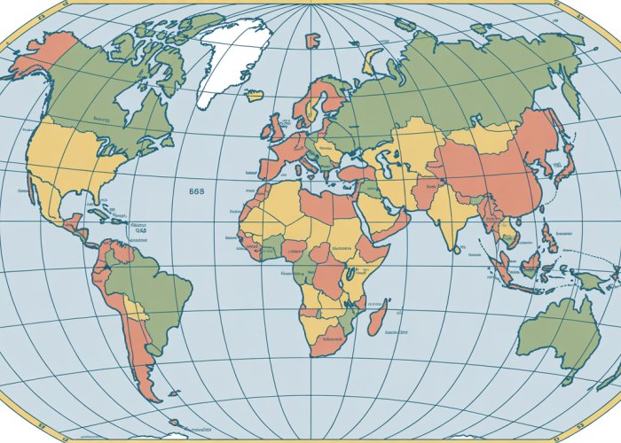
For example, the Mercator projection, famous for its use in nautical charts, accurately depicts direction but distorts area, particularly at higher latitudes. In contrast, equal-area projections maintain accurate area representation but distort shapes. The selection of an appropriate projection is a crucial decision for any cartographer.
Beyond Latitude and Longitude: Coordinate Systems
While latitude and longitude form the basis of geographic coordinates, numerous other coordinate systems exist, each designed for specific applications. These systems build upon the foundational principles of latitude and longitude, offering alternative ways to represent spatial data.
Universal Transverse Mercator (UTM)
The Universal Transverse Mercator (UTM) system is a widely used grid-based system that divides the Earth into zones, each with its own transverse Mercator projection. This approach minimizes distortion within each zone, making UTM suitable for accurate measurements and mapping over smaller areas.
UTM is particularly useful for applications requiring precise location data, such as surveying, engineering, and military operations. The UTM system references locations by easting and northing coordinates within a specific zone.
World Geodetic System 1984 (WGS 84)
The World Geodetic System 1984 (WGS 84) is a global geodetic datum that serves as the foundation for GPS (Global Positioning System) and many other mapping and surveying applications. It defines the Earth’s shape and size and provides a reference frame for accurately determining positions on the Earth’s surface.
WGS 84 is a geocentric coordinate system, meaning its origin is located at the Earth’s center of mass. Its widespread adoption has made it a standard for global mapping and navigation.
Modern Applications: Geographic Information Systems (GIS)
The culmination of cartography, coordinate systems, and computational power can be found in Geographic Information Systems (GIS). GIS software allows users to capture, store, analyze, and display spatial data, creating powerful tools for decision-making in a wide range of fields.
From urban planning and environmental management to transportation logistics and disaster response, GIS provides invaluable insights into the spatial relationships between different phenomena. By integrating data from various sources, GIS enables users to identify patterns, trends, and anomalies that would be difficult or impossible to detect otherwise.
The ability to visualize and analyze spatial data has revolutionized how we understand and interact with the world around us. GIS is no longer a niche technology but a mainstream tool used by professionals and researchers across diverse disciplines.
So, there you have it! Hopefully, you now have a better grasp on the basics of latitude longitude earth. Get out there (metaphorically, or literally!), explore the world, and remember that every place has its unique coordinates. Happy travels!