The Java Trench, a prominent feature of the Indo-Australian Plate boundary, is a crucial location for understanding subduction zones. Seismic activity, heavily studied using data from the Global Seismographic Network, reveals important information about the forces at play. The depths of the java trench location present unique challenges and opportunities for research, yielding critical insights for scientists working within the field of plate tectonics. Investigating the java trench location provides invaluable details concerning earth’s deepest secrets.
The Java Trench, also known as the Sunda Trench, represents one of Earth’s most profound and captivating geological formations. Carved into the floor of the Indian Ocean, this elongated depression plunges to depths exceeding 7,700 meters (25,300 feet), making it one of the deepest points on our planet. Its sheer scale and strategic location make it a crucial area for understanding a multitude of geological processes.
The Significance of Oceanic Trenches
Oceanic trenches, like the Java Trench, are more than just deep spots in the ocean. They represent zones where the Earth’s tectonic plates converge, and one plate is forced beneath another in a process known as subduction. These are the primary sites where the Earth’s crust is recycled back into the mantle.
The study of these trenches provides invaluable insights into a range of phenomena:
- Plate Tectonics: Understanding plate movement and interaction.
- Earthquake Generation: Identifying the mechanisms behind seismic activity.
- Tsunami Formation: Analyzing the causes and potential impact of these devastating waves.
- Geochemical Cycling: Investigating how materials are transported between the Earth’s surface and interior.
Studying these trenches allows us to better grasp the dynamics of our planet.
Article Focus and Thesis Statement
This article delves into the intricate details of the Java Trench, unraveling its mysteries through a focused exploration of its key characteristics.
We will investigate its precise location within the Indian Ocean and the implications of its proximity to Indonesia. We will analyze the geological processes responsible for its formation, specifically the interplay between the Indo-Australian and Eurasian plates. Finally, we will consider its broader role in the context of plate tectonics and subduction zones.
Ultimately, this exploration aims to provide a comprehensive understanding of the Java Trench. It will emphasize its significance as a window into Earth’s dynamic processes and its crucial role in shaping the geological landscape of the region.
The insights gleaned from studying oceanic trenches offer invaluable perspective on our planet’s workings. But to truly understand the Java Trench, we must first pinpoint its location and examine the geographical context that shapes its existence.
Locating the Abyss: Geography and Regional Context
The Java Trench, a crescent-shaped depression, carves a dramatic scar across the eastern Indian Ocean floor. Its precise location lies south of Indonesia, extending roughly parallel to the archipelago’s string of islands.
Precise Coordinates and Regional Setting
Geographically, the Java Trench stretches approximately 3,200 kilometers (2,000 miles) along the seabed. Its deepest point, the Weber Deep, plunges to an astounding 7,434 meters (24,390 feet).
To pinpoint its location using coordinates, the trench runs roughly from 10°S 108°E to 13°S 118°E.
This places it within a complex tectonic setting, defined by the convergence of major lithospheric plates.
Proximity to Indonesia: A Double-Edged Sword
The Java Trench’s proximity to Indonesia is no mere coincidence. It’s a direct consequence of the ongoing subduction of the Indo-Australian Plate beneath the Eurasian Plate.
This geological setting has profoundly shaped the Indonesian archipelago.
On one hand, the subduction process is responsible for the formation of Indonesia’s volcanic islands. Magma generated from the melting of the subducting plate rises to the surface, fueling volcanic activity.
On the other hand, this tectonic activity poses significant geological hazards to the region.
The frequent earthquakes and tsunamis that plague Indonesia are directly linked to the processes occurring at the Java Trench.
The immense pressure and friction between the plates can cause sudden releases of energy, resulting in devastating seismic events.
Hazard Potential
The most concerning hazard associated with the Java Trench is the potential for large-scale earthquakes and tsunamis.
The 2004 Indian Ocean tsunami, triggered by an earthquake along the subduction zone, serves as a stark reminder of the destructive power of these events.
Understanding the seismic activity and fault lines within the Java Trench is vital. It is essential for developing effective early warning systems and mitigation strategies to protect vulnerable coastal communities.
Visual Aids: Mapping the Abyss
To truly grasp the Java Trench’s location and relationship to Indonesia, visual aids are crucial. Maps illustrating the Indian Ocean, with the trench clearly marked, offer a comprehensive overview.
Detailed bathymetric maps can reveal the trench’s depth and morphology, showcasing its dramatic relief.
Furthermore, tectonic maps highlighting the plate boundaries and fault lines in the region can illustrate the dynamic forces at play.
Satellite imagery and 3D models can provide another level of perspective, revealing the true scale of this underwater feature and its surrounding geological landscape. These visual tools are invaluable for researchers, policymakers, and the general public alike, fostering a deeper understanding of the Java Trench and its significance.
The immense pressure and friction between the Indo-Australian and Eurasian plates doesn’t just define the region’s geological hazards; it’s the very sculptor of the Java Trench itself. Understanding this requires diving deep into the fundamental forces that shape our planet.
Formation: A Symphony of Tectonic Plates
The Java Trench is not a random scar on the ocean floor. It’s a direct consequence of the grand, ongoing process of plate tectonics. To understand its formation, we must explore the underlying mechanics of this planetary phenomenon and the critical role of subduction zones.
The Dance of Giants: Plate Tectonics and Subduction
The Earth’s lithosphere is fragmented into several large and small plates that are constantly moving, albeit very slowly, across the underlying asthenosphere.
These plates interact at their boundaries, creating various geological features, including mountains, volcanoes, and, of course, oceanic trenches.
Where two plates converge, one may slide beneath the other in a process known as subduction. This process is fundamental to the formation of oceanic trenches.
The denser plate, typically an oceanic plate, is forced downwards into the mantle. This creates a deep, V-shaped depression on the ocean floor – an oceanic trench.
The Indo-Australian and Eurasian Plates: A Head-On Collision
The Java Trench exists because the Indo-Australian Plate is colliding with and subducting beneath the Eurasian Plate.
This collision is not a smooth, continuous process. The Indo-Australian Plate is moving northwards, driven by forces deep within the Earth.
As it collides with the Eurasian Plate, the denser oceanic crust of the Indo-Australian Plate is forced downwards.
The immense pressure and friction generated during this subduction process warp and fracture the crust, creating the dramatic depression we know as the Java Trench.
The angle of subduction, the rate of convergence, and the properties of the rocks involved all contribute to the specific characteristics of the trench, including its depth and shape.
Subduction’s Fury: Earthquakes and Tsunamis
The subduction process at the Java Trench is not just a slow, geological phenomenon. It’s also the source of some of the region’s most devastating natural disasters.
Earthquakes: The Tremors of the Deep
As the Indo-Australian Plate grinds beneath the Eurasian Plate, immense stress builds up along the fault line.
When this stress exceeds the strength of the rocks, they suddenly rupture, releasing vast amounts of energy in the form of earthquakes.
These earthquakes can be incredibly powerful, causing widespread destruction on land and triggering other geological hazards.
The location of the Java Trench directly correlates with a zone of high seismic activity, making Indonesia particularly vulnerable to earthquake-related disasters.
Tsunamis: The Walls of Water
Perhaps the most devastating consequence of subduction-related earthquakes is the potential for tsunamis.
When a large earthquake occurs beneath the ocean floor, it can suddenly displace a massive volume of water.
This displacement generates a series of powerful waves that radiate outwards from the epicenter.
As these waves approach shallower coastal waters, they slow down and their amplitude increases dramatically, creating towering walls of water that can inundate coastal communities.
The 2004 Indian Ocean tsunami, triggered by a massive earthquake off the coast of Sumatra, is a stark reminder of the destructive power of these waves and the direct link between subduction processes and catastrophic events. The Java Trench, as part of this subduction zone, plays a critical role in generating such hazards.
Java Trench in Context: A Comparative Analysis
The relentless dance of tectonic plates carves distinct features onto our planet, and among the most dramatic are oceanic trenches. But while these abyssal plains share a common origin in subduction zones, each trench possesses unique characteristics shaped by its specific geological context. To fully appreciate the Java Trench, we must place it alongside its counterparts and examine how its features impact our ability to study it.
Distinguishing Features of the Java Trench
The Java Trench, while sharing the fundamental V-shape of other oceanic trenches, exhibits notable differences in depth, morphology, and geological setting.
Its maximum depth, while considerable, is less than that of some other trenches, such as the Mariana Trench. This shallower depth influences the pressure regimes and biological communities found within its depths.
Furthermore, the proximity of the Java Trench to the Indonesian archipelago has a profound impact on its characteristics.
Sediment runoff from the islands contributes to a higher sedimentation rate within the trench compared to trenches located further from landmasses. This impacts the composition of the trench floor and the types of geological processes that occur there.
Java Trench vs. Mariana Trench: A Tale of Two Abysses
The Mariana Trench, the deepest point on Earth, serves as a particularly useful point of comparison for understanding the Java Trench. While both are products of subduction, their geological settings differ significantly.
The Mariana Trench is located in a relatively isolated region of the Pacific Ocean, far from major landmasses. This results in lower sedimentation rates and a more pristine deep-sea environment.
In contrast, the Java Trench is situated in a complex tectonic region with significant sediment input from nearby land.
This difference in setting has a profound impact on seafloor exploration.
The extreme depth of the Mariana Trench poses significant challenges for exploration, requiring specialized equipment and techniques.
While the Java Trench is still a challenging environment, its shallower depth and higher sedimentation rates present different obstacles for researchers.
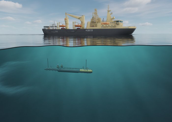
Mapping the Abyss: Seafloor Mapping and Bathymetry
Understanding the topography of the Java Trench relies heavily on seafloor mapping techniques, particularly bathymetry. Bathymetry is the measurement of ocean depth, and it provides crucial data for creating detailed maps of the trench’s morphology.
Traditional methods of bathymetry involve using sonar to measure the time it takes for sound waves to travel to the seafloor and back. This data is then used to calculate depth and create bathymetric maps.
However, the extreme depths and rugged terrain of the Java Trench pose challenges for traditional sonar mapping.
Newer technologies, such as multibeam sonar, offer improved resolution and coverage, allowing for more detailed mapping of the trench.
These advanced techniques are crucial for understanding the complex geological processes that shape the Java Trench.
Furthermore, bathymetric data is essential for assessing the potential hazards associated with the trench, such as earthquakes and tsunamis.
Detailed maps of the seafloor can help identify areas that are prone to landslides or other geological instability, allowing for better risk assessment and mitigation strategies.
Frequently Asked Questions About the Java Trench
Here are some frequently asked questions to help you better understand the Java Trench and its significance.
Where exactly is the Java Trench located?
The Java Trench, also known as the Sunda Trench, is located in the eastern Indian Ocean. It runs southwest of Java and Sumatra in Indonesia. Its specific location marks a zone of significant tectonic activity.
How deep is the deepest point in the Java Trench?
The deepest point in the Java Trench reaches approximately 7,725 meters (25,344 feet). This makes it one of the deepest points on Earth. Understanding the java trench location is crucial to studying these extreme depths.
What makes the Java Trench so significant for scientists?
The Java Trench is significant due to its extreme depth and its location at a subduction zone where the Indo-Australian Plate is diving beneath the Eurasian Plate. This makes it a prime location for studying earthquakes, tsunamis, and the Earth’s geological processes. Investigating the java trench location helps reveal insights into plate tectonics.
What can studying the Java Trench tell us about tsunamis?
Because of its active subduction zone, the Java Trench is a region prone to generating tsunamis. Studying the seismic activity and geological features specific to the java trench location can provide valuable data for improving tsunami early warning systems and understanding their formation.
So, that’s a little dive into the Java Trench location! Hopefully, you found something interesting in that incredible depth. Until next time!