Accurate navigation requires a solid understanding of spatial relationships. Cartography, the science of mapmaking, employs compasses to determine precise cardinal intermediate directions. The United States Geological Survey (USGS) provides detailed topographical maps, emphasizing the importance of these directions for accurate terrain interpretation. Furthermore, skilled navigators utilize these directional concepts for efficient route planning and orientation. Comprehending cardinal intermediate directions is fundamental, therefore, for both understanding maps and real-world wayfinding.
In the tapestry of our daily lives, the ability to navigate effectively is more fundamental than we often realize. From the mundane act of commuting to work to the exhilarating experience of exploring uncharted territories, we are constantly making directional decisions. Understanding direction isn’t just about getting from point A to point B; it’s about spatial awareness, cognitive mapping, and a deeper connection to our surroundings.
At its core, navigation relies on a robust understanding of cardinal and intermediate directions. These directions serve as the foundational elements upon which our understanding of spatial relationships is built. Without a solid grasp of these basic principles, we are essentially wandering without a compass, lost in a sea of possibilities.
The Ubiquity of Navigation
Consider the sheer number of times you rely on directional knowledge each day. From following GPS directions to a new restaurant to providing someone with instructions to your home, navigation permeates our activities.
Whether you’re an experienced traveler or simply making your way through your neighborhood, the ability to understand and apply directional concepts is paramount.
The ease with which we often navigate using technology can sometimes mask the importance of these fundamental skills, but a true understanding goes beyond simply following a screen.
Cardinal and Intermediate Directions: The Building Blocks
Cardinal directions – North, South, East, and West – are the cornerstones of orientation. They provide a fixed reference point, allowing us to establish our position relative to the world around us.
Similarly, the intermediate directions – Northeast, Northwest, Southeast, and Southwest – add another layer of precision, enabling finer distinctions in our spatial awareness.
These directions, when combined, offer a comprehensive framework for understanding and describing spatial relationships. Mastering these foundational elements allows us to navigate with confidence and clarity.
Mastering Direction: A Guide to Spatial Awareness
This guide aims to provide you with a comprehensive overview of cardinal and intermediate directions. We will equip you with the knowledge and skills necessary to improve your orientation and navigation abilities.
By delving into the definitions, methods of determination, and practical applications of these directions, you will gain a deeper understanding of the world around you.
Ultimately, our goal is to empower you to navigate your life with greater confidence, spatial awareness, and a heightened sense of direction.
In our journey to becoming spatially aware individuals, grasping the cardinal and intermediate directions becomes paramount.
We’ve established the pervasive role of navigation in our lives, from everyday commutes to grand explorations. Now, let’s delve into the fundamental elements that underpin our understanding of direction: the cardinal directions.
Cardinal Directions: The Foundation of Navigation
The cardinal directions – North, South, East, and West – are the absolute bedrock upon which all other forms of directional understanding are built.
They are the primary reference points, the four corners of our spatial world, and understanding them is crucial for effective navigation.
Defining the Cardinal Points
Let’s precisely define each cardinal direction:
-
North: The direction pointing towards the North Pole. It is often used as the primary reference point in navigation.
-
South: The direction opposite to North, pointing towards the South Pole.
-
East: The direction perpendicular to North and South, aligned with the Earth’s rotation.
-
West: The direction opposite to East.
These four directions form the framework within which we orient ourselves and understand our surroundings.
Methods for Determining Cardinal Directions
Throughout history, various methods have been developed to determine the cardinal directions, each relying on different natural phenomena:
The Sun’s Position
The sun’s path across the sky can be a valuable tool for estimating direction.
In the Northern Hemisphere, the sun rises in the East, reaches its highest point in the sky (approximately South) at midday, and sets in the West.
However, it’s important to remember that this is an approximation, as the sun’s exact position varies with the seasons.
Observing the Stars: The North Star
In the Northern Hemisphere, the North Star (Polaris) is a reliable indicator of North.
Its position remains relatively constant in the night sky, making it a consistent reference point.
To find the North Star, locate the Big Dipper constellation and follow the two stars that form the end of the "cup" upwards; they point directly to Polaris.
Using a Compass
The compass is perhaps the most reliable and widely used tool for determining cardinal directions.
It utilizes the Earth’s magnetic field to align a magnetized needle, indicating the direction of magnetic North.
While compasses are generally accurate, it’s essential to be aware of potential sources of error, such as magnetic interference from metal objects or electronic devices.
Historical Significance in Navigation and Cartography
Cardinal directions have played a pivotal role in the history of navigation and the development of cartography:
-
Early Navigation: Ancient mariners relied heavily on celestial navigation, using the sun and stars to determine direction and navigate the seas.
-
Development of Maps: The cardinal directions are fundamental to mapmaking, providing the framework for representing spatial relationships and orienting users to the mapped area.
The development of accurate maps was essential for trade, exploration, and military strategy.
-
Cartography: From the earliest rudimentary maps to modern digital mapping systems, the cardinal directions have remained an indispensable element.
The understanding of cardinal directions is more than just a practical skill; it’s a connection to our history and a foundation for navigating the world around us.
Having established the foundational cardinal directions, our navigational toolkit would remain limited if those were all we had to work with.
The world rarely presents itself in absolutes of North, South, East, or West. To truly refine our spatial understanding, we must incorporate the intermediate directions.
Intermediate Directions: Adding Precision to Your Bearings
The intermediate directions – Northeast, Northwest, Southeast, and Southwest – bridge the gaps between the cardinal points. They offer a level of granularity essential for precise navigation and detailed spatial reasoning. Understanding them significantly enhances our ability to describe locations and chart courses.
Defining the Intermediate Points
The intermediate directions are, in essence, the bisectors of the angles formed by the cardinal directions. Each one lies precisely midway between two cardinal points, providing a more nuanced directional reference.
Let’s define each one with clarity:
-
Northeast (NE): The direction located exactly between North and East.
-
Northwest (NW): The direction located exactly between North and West.
-
Southeast (SE): The direction located exactly between South and East.
-
Southwest (SW): The direction located exactly between South and West.
These four directions augment the cardinal directions, increasing the resolution of our directional vocabulary.
Deriving Intermediate Directions
Each intermediate direction inherently contains the essence of the two cardinal directions from which it is derived. Northeast, for instance, is neither purely North nor purely East.
Instead, it represents an equal combination of both. This relationship is crucial for understanding their positions on a compass rose or map.
To visualize, imagine a pie cut into quarters representing the cardinal directions. The intermediate directions are the lines that would perfectly bisect each of those quarters.
This derivation principle makes it easier to remember and locate the intermediate directions relative to the cardinal ones.
Practical Applications of Intermediate Directions
The utility of intermediate directions becomes apparent in scenarios demanding precision. Whether navigating a dense forest, providing detailed instructions, or using advanced mapping technologies, they are invaluable.
Consider these examples:
-
Orienteering: In orienteering, participants use a map and compass to navigate through unfamiliar terrain. Intermediate directions enable competitors to follow more intricate routes and pinpoint locations with greater accuracy.
-
Giving Directions: Instead of simply saying "Go East," one can say "Head Northeast," offering more specific and helpful guidance. This level of detail is particularly useful in urban environments or complex road networks.
-
Aviation and Sailing: Pilots and sailors rely on precise headings to maintain their course. The intermediate directions are indispensable for plotting routes that deviate from the primary cardinal directions.
-
Geographic Descriptions: Describing a mountain range as extending in a "Northwest to Southeast" direction provides a far clearer picture than simply stating it runs "North to South" or "East to West."
The incorporation of intermediate directions into our navigational framework significantly elevates our capacity to interact with and understand the spatial world. They bridge the gaps, offering a richer and more versatile vocabulary for describing location and movement.
Having mastered the cardinal and intermediate directions, we’re now equipped to translate that knowledge into practical application. But how can we consistently and accurately determine those directions, regardless of the time of day or visibility? The answer lies in a time-tested tool: the compass.
The Compass: A Reliable Tool for Direction Finding
The compass stands as a testament to human ingenuity, a pocket-sized instrument that unlocks the secrets of orientation. Its reliability stems from a fundamental interaction with the Earth’s magnetic field, offering consistent directional guidance in almost any environment. Understanding the compass, both its principles and its practical use, is paramount for anyone serious about navigation.
Understanding the Compass’s Core Principles
At its heart, a compass operates on a simple yet profound principle: alignment with the Earth’s magnetic field. The Earth behaves as if it has a giant bar magnet running through its core, generating a magnetic field that extends out into space.
A compass needle, typically made of magnetized metal, is free to rotate. This allows it to align itself with this magnetic field.
The needle’s magnetized end is drawn towards the Earth’s magnetic north pole, providing a consistent reference point for determining direction. It’s important to note that magnetic north is not the same as true north (the geographic North Pole), but the compass remains remarkably accurate.
This difference, known as magnetic declination, varies depending on location and can be accounted for with the use of maps or online resources.
Step-by-Step Guide to Compass Navigation
Using a compass effectively requires a systematic approach. Here’s a step-by-step guide to ensure accuracy:
-
Hold the Compass Level: Place the compass on a flat surface or hold it steadily in your hand. Avoid tilting the compass, as this can affect the needle’s movement and accuracy.
-
Release the Needle: If your compass has a needle lock, release it to allow the needle to swing freely.
-
Orient the Compass Housing: Rotate the compass housing until the north marking on the housing (often marked with an "N" or a depiction of north) aligns with the north end of the magnetic needle. Some compasses will have a red end indicating North.
-
Determine Your Direction: Once the needle and housing are aligned, you can read your direction from the compass housing. Find the degree marking that aligns with the direction of travel or the object you are trying to locate.
-
Follow Your Bearing: Maintaining the alignment between the needle and the north marking on the housing, move in the direction indicated by your chosen bearing.
Mitigating Potential Errors: Staying on Course
While compasses are reliable, they are not infallible. Magnetic interference represents the most common source of error. Metal objects, electronic devices, and even power lines can disrupt the Earth’s magnetic field, causing the compass needle to deviate.
To mitigate magnetic interference:
-
Move away from metal objects, such as vehicles, fences, or metal structures.
-
Keep electronic devices, including cell phones and GPS units, away from the compass while taking a reading.
-
Be aware of overhead power lines or underground cables that may generate magnetic fields.
Another factor that leads to errors can be local magnetic anomalies. These are unusual magnetic disturbances found in some areas of the world. Consulting a local map or guide can help identify and account for these anomalies.
By understanding the compass’s principles, practicing proper usage, and being mindful of potential sources of error, you can harness its power to navigate with confidence and precision.
Having a firm grasp of the compass and its mechanics, we’re now ready to transition from the abstract to the visual. While a compass provides a precise bearing at a single point, maps offer a broader perspective, allowing us to understand our position in relation to the surrounding world. They are visual representations of spatial relationships, and understanding how directions are depicted on maps is crucial for effective navigation.
Maps: Visualizing Direction and Spatial Relationships
Maps are more than just pretty pictures; they are sophisticated tools that translate the three-dimensional world onto a two-dimensional surface. They provide a critical framework for understanding direction, distance, and the relationships between geographical features. By learning how to interpret the directional information embedded within a map, you unlock its full potential for navigation and spatial awareness.
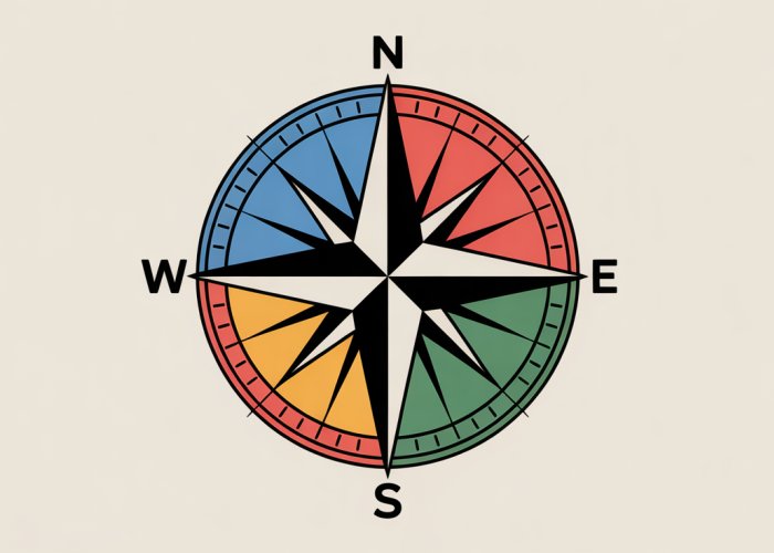
The Compass Rose: A Map’s Directional Guide
One of the most common ways maps represent cardinal and intermediate directions is through a compass rose. This symbolic figure, often found prominently displayed on a map, visually indicates the orientation of North, South, East, and West.
More elaborate compass roses may also include the intermediate directions (Northeast, Southeast, Southwest, Northwest) and even finer directional divisions for increased precision. Understanding the compass rose is the first step in orienting yourself to the map and understanding the relative positions of different locations.
Often, instead of a compass rose, maps might simply use a directional arrow, typically pointing North. This arrow serves the same fundamental purpose: to provide a reference point for understanding direction on the map. Always look for either a compass rose or directional arrow when first examining a map.
Correlating Map Directions with the Real World
The true power of a map lies in its ability to help you correlate directional information with real-world landmarks and geographic features. A map allows you to visually connect what you see on paper with what you observe in your surroundings.
For example, if the map indicates that a specific mountain range lies to the northwest of your current location, you can look to the northwest using your compass to confirm this direction and visually identify the mountain range. This process of correlating map data with real-world observations is essential for effective navigation.
Identifying prominent landmarks on both the map and in the landscape is a key skill. Look for features like rivers, lakes, roads, and distinctive buildings. These landmarks act as reference points, helping you to pinpoint your location on the map and maintain your sense of direction as you travel.
Understanding Map Scale and Accuracy
Map scale refers to the ratio between a distance on the map and the corresponding distance on the ground. It’s typically expressed as a ratio (e.g., 1:24,000) or a graphical scale bar. Understanding map scale is crucial because it directly affects the level of detail and the accuracy with which you can determine distances and directions.
A large-scale map (e.g., 1:24,000) covers a smaller area but shows more detail, making it ideal for navigating in localized areas. Conversely, a small-scale map (e.g., 1:100,000) covers a larger area but shows less detail, which is useful for planning longer journeys.
Map projections are methods used to represent the curved surface of the Earth on a flat map. Since it is impossible to perfectly flatten a sphere, all map projections introduce some degree of distortion.
Different map projections distort different properties, such as area, shape, distance, or direction. Being aware of the projection used on a particular map is important for understanding the potential limitations of its directional accuracy, especially over large distances. For critical navigation, it is important to reference your map’s projection and apply corrections where appropriate.
Having a firm grasp of the compass and its mechanics, we’re now ready to transition from the abstract to the visual. While a compass provides a precise bearing at a single point, maps offer a broader perspective, allowing us to understand our position in relation to the surrounding world. They are visual representations of spatial relationships, and understanding how directions are depicted on maps is crucial for effective navigation.
Landmarks: Navigating with Environmental Cues
Maps and compasses are invaluable tools, but they are not the only resources available for wayfinding. Our environment is rich with visual information, and learning to interpret these environmental cues can significantly enhance our navigational abilities. These environmental cues can be used to maintain a sense of direction and drastically improve our navigation skills, especially when technology fails or maps are unavailable.
The Importance of Visual Cues
Landmarks serve as visual anchors, helping us maintain our orientation and direction in our surroundings. They provide a tangible connection between our location and our intended path. Without landmarks, we are forced to rely solely on abstract concepts of direction, which can easily become disoriented, particularly in unfamiliar environments.
Landmarks act as confirmation points, verifying that we are on the correct route.
They also create a mental map of the environment, which is a cognitive representation of our surroundings. This mental map is constructed by combining our understanding of cardinal directions with the location and relationship of various landmarks.
By recognizing and remembering landmarks, we can navigate more confidently and efficiently.
Common Types of Landmarks
Landmarks can be anything that is visually distinctive and relatively stable in the environment. They can be broadly categorized into:
-
Built Environment: These include prominent buildings, bridges, towers, statues, and other man-made structures. Their unique architectural features, size, or color make them easily recognizable.
-
Natural Features: Mountains, rivers, lakes, forests, and unique rock formations serve as natural landmarks. These are particularly useful in rural or wilderness settings where man-made structures are scarce.
-
Infrastructure Elements: Distinctive road signs, unique fences, power lines, and other infrastructure elements can serve as reliable landmarks, particularly along roads and trails.
Utilizing Landmarks Effectively for Navigation
Mastering the art of landmark-based navigation requires careful observation, memory, and spatial reasoning. Here are some tips for effectively using landmarks to improve your navigation skills:
Creating Mental Maps
The cornerstone of landmark navigation is the ability to create accurate mental maps. As you move through an environment, actively observe and memorize the locations of key landmarks in relation to each other and to your starting point.
Visualize the distances and directions between these landmarks. Use your understanding of cardinal directions to orient your mental map, ensuring that you maintain a consistent sense of direction.
Pay Attention to Relative Positions
Simply identifying landmarks is not enough. You must also understand their relative positions.
Consider the angle at which you see a landmark from your current location.
Note the distance between you and the landmark and how this distance changes as you move. This relative positioning provides crucial information about your location and direction of travel.
Look Back Occasionally
When navigating using landmarks, it’s easy to focus solely on what lies ahead. However, it’s equally important to occasionally look back to observe how the environment appears from the opposite direction.
This backward perspective can reveal new landmarks or provide a different view of familiar ones, reinforcing your mental map and improving your overall orientation.
Combine Landmarks with Other Techniques
Landmark-based navigation is most effective when combined with other directional tools and techniques. Use a compass to confirm your general direction of travel and a map to understand the broader layout of the environment.
By integrating landmarks with these other resources, you create a more robust and reliable navigation strategy.
Be Aware of Changes
Landmarks are not always permanent. Buildings can be demolished, trees can be cut down, and signs can be moved or replaced.
Be aware of potential changes in the environment and update your mental map accordingly. Regularly re-evaluate your landmarks to ensure that they remain reliable navigational aids.
By mastering the art of landmark-based navigation, you can develop a deeper connection to your surroundings and become a more confident and capable navigator. Even with the convenience of modern technology, the ability to interpret and utilize environmental cues remains an invaluable skill.
Maps and compasses are invaluable tools, but they are not the only resources available for wayfinding. Our environment is rich with visual information, and learning to interpret these environmental cues can significantly enhance our navigational abilities. These environmental cues can be used to maintain a sense of direction and drastically improve our navigation skills, especially when technology fails or maps are unavailable. Thankfully, in the modern world, we have access to GPS technology.
GPS and Traditional Directions: A Synergistic Approach
Global Positioning System (GPS) technology has revolutionized navigation, offering unprecedented accuracy and convenience. However, relying solely on GPS can be a risky proposition. A truly skilled navigator understands how to leverage GPS in conjunction with a solid foundation of traditional directional knowledge. This synergistic approach ensures optimal wayfinding, even when technology falters.
How GPS Determines Location and Direction
GPS technology relies on a network of satellites orbiting the Earth. These satellites transmit signals that GPS receivers on the ground use to calculate their precise location. By processing signals from multiple satellites, a GPS device can determine latitude, longitude, altitude, and direction of travel.
This information is then displayed on a map interface, providing users with real-time location updates and turn-by-turn navigation. The system has become integral to daily life, from driving directions to tracking fitness activities.
The Benefits of a Synergistic Approach
While GPS offers remarkable capabilities, it’s crucial to recognize its limitations. Relying solely on GPS can lead to complacency and a diminished sense of spatial awareness. Understanding cardinal and intermediate directions enhances your ability to interpret GPS data critically.
For example, if your GPS indicates you should be traveling north, but your intuition and observation of the surrounding terrain suggest otherwise, a solid understanding of direction allows you to question the GPS and make informed decisions.
This combination of technological assistance and fundamental navigational skills fosters a more robust and adaptable approach to wayfinding.
Here are some benefits of using GPS in conjunction with traditional knowledge:
-
Enhanced Situational Awareness: Understanding cardinal directions helps you maintain a broader sense of your surroundings, even when following GPS instructions.
-
Improved Route Planning: Knowledge of direction allows you to assess the overall logic of a GPS-generated route and identify potential shortcuts or alternative paths.
-
Increased Confidence: Combining GPS with traditional skills fosters a sense of self-reliance and confidence in your ability to navigate, regardless of technological assistance.
When Traditional Directional Knowledge is Crucial
Despite the advancements in GPS technology, there are numerous situations where traditional directional knowledge remains essential:
-
Signal Loss: GPS signals can be unreliable or unavailable in remote areas, dense forests, urban canyons, or underground locations. In these scenarios, a compass and map are invaluable tools for maintaining orientation.
-
Battery Failure: GPS devices rely on batteries, which can fail unexpectedly. A dead battery renders the device useless, leaving you stranded without directional assistance.
-
Device Malfunction: Electronic devices are susceptible to malfunction due to damage, software glitches, or extreme weather conditions.
-
Emergency Situations: In emergency situations, such as natural disasters or search and rescue operations, GPS may be unreliable or unavailable. Traditional navigational skills can be the difference between safety and peril.
-
Wilderness Navigation: Hiking, camping, or backpacking in the wilderness requires a deep understanding of directional skills, as GPS coverage is often limited or non-existent.
-
Educational Value: Learning traditional navigation skills fosters a deeper appreciation for the natural world and enhances your problem-solving abilities.
In conclusion, while GPS technology provides a convenient and powerful tool for navigation, it should not replace the fundamental understanding of cardinal and intermediate directions. A synergistic approach that combines the benefits of GPS with traditional navigational skills is the most effective way to ensure safe and successful wayfinding in any environment.
Real-World Applications: Harnessing Directional Knowledge
The mastery of cardinal and intermediate directions transcends theoretical knowledge; it’s a practical skill with far-reaching applications in various domains. From guiding aircraft to charting unexplored territories, directional awareness proves indispensable. Understanding how these directions manifest in real-world scenarios underscores the value of spatial orientation.
Navigation Across Industries: A Compass for Success
Several industries rely heavily on a sound understanding of cardinal and intermediate directions. This knowledge isn’t merely supplemental; it’s often fundamental to their operations.
-
Aviation: Pilots depend on directional knowledge for flight planning, navigation, and maintaining course. Understanding headings, wind direction, and airspace restrictions requires a firm grasp of cardinal and intermediate directions. Precise directional control is crucial for safety and efficiency in air travel.
-
Sailing: Navigating the seas has always relied on directional expertise. Sailors use compasses, charts, and celestial navigation to determine their position and plot courses. Accounting for currents, tides, and wind direction necessitates a deep understanding of cardinal and intermediate directions.
-
Surveying: Surveyors employ precise measurements and directional data to map land, establish boundaries, and plan construction projects. They utilize instruments like theodolites and GPS to determine angles and distances, all of which are referenced to cardinal directions. Accuracy in surveying is paramount, and directional knowledge is at its core.
-
Urban Planning: City planners consider orientation and directional flow when designing streets, buildings, and public spaces. They analyze sun angles, wind patterns, and traffic flow to optimize layouts for functionality and sustainability. Understanding cardinal directions informs decisions about building orientation and street grid design.
Enhancing Travel Experiences: A Deeper Connection with the World
Directional knowledge elevates travel from simple sightseeing to immersive exploration. Armed with a solid understanding of cardinal and intermediate directions, travelers can:
-
Navigate unfamiliar cities with confidence. Using a map and compass or simply observing the sun’s position can prevent disorientation and allow for independent exploration.
-
Understand the layout of historical sites and landmarks. Knowing the orientation of buildings and monuments adds depth to the experience and provides context for their historical significance.
-
Engage in outdoor activities with greater awareness. Hikers, campers, and adventurers can use directional skills to navigate trails, locate water sources, and avoid getting lost.
In essence, directional knowledge transforms the traveler from a passive observer to an active participant, fostering a deeper connection with the environment and enriching the overall experience.
Directional Awareness in Emergencies: A Lifeline When It Matters Most
In emergency situations, directional awareness can be a critical survival skill. When technology fails or familiar landmarks are obscured, the ability to determine direction can make the difference between safety and peril.
-
Lost in the wilderness: Understanding how to use the sun, stars, or a makeshift compass to determine direction can guide individuals back to civilization.
-
Natural disasters: During earthquakes, floods, or hurricanes, directional knowledge can help people evacuate to safer ground and locate essential resources.
-
Search and rescue operations: Emergency responders rely on directional expertise to navigate challenging terrains and locate missing persons.
Directional awareness isn’t just a theoretical concept; it’s a practical skill that can save lives in challenging circumstances. Developing this skill is an investment in personal safety and preparedness.
FAQs: Mastering Cardinal & Intermediate Directions
This section addresses common questions about understanding and using cardinal and intermediate directions for navigation.
What exactly are cardinal directions?
Cardinal directions are the four main points of a compass: North, South, East, and West. They form the foundation for understanding other directional references and are essential for basic navigation.
What are intermediate directions, and how do they relate to cardinal directions?
Intermediate directions fall between the cardinal directions. These include Northeast, Southeast, Northwest, and Southwest. They offer more precise directional information and are derived by combining cardinal directions. For example, Northeast is directly between North and East.
How are cardinal and intermediate directions used in real-world navigation?
Cardinal and intermediate directions are used constantly in everyday life. They are used when giving driving directions, reading maps, understanding weather patterns (wind direction), and even orienting yourself in a new city. They provide a common frame of reference.
Why is it important to learn both cardinal and intermediate directions?
Understanding both cardinal and intermediate directions provides a more complete understanding of spatial relationships and improves your navigational skills. Learning these directions empowers you to navigate accurately and communicate your location effectively.
Alright, adventurers! Hopefully, you’ve got a better handle on cardinal intermediate directions now. Go explore, get a little lost (but not too lost!), and remember what you learned here. Happy travels!