Navigation, a crucial element for exploration and trade, historically relied on instruments like the Astrolabe. The Compass, another pivotal invention, offered directionality independent of celestial observation. Debates about astrolabe vs compass often highlight their respective strengths and weaknesses. The Maritime Silk Road, a network of trade routes, showcases how both tools facilitated long-distance voyages. Understanding the significance of both the astrolabe and the compass requires considering the contributions of institutions like the Royal Geographical Society to navigation’s advancement.
The history of exploration is inextricably linked to the development of navigational technology. Among the myriad tools devised to conquer the vast unknown, the astrolabe and the compass stand as particularly significant.
These instruments, each born of distinct scientific principles and cultural contexts, empowered seafarers to venture beyond familiar coastlines, fundamentally reshaping global trade, cultural exchange, and geopolitical power dynamics.
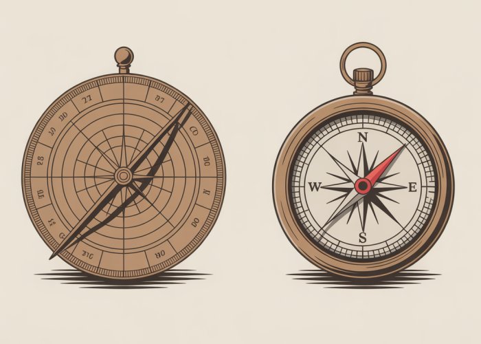
The Astrolabe and Compass: Cornerstones of Navigation
The astrolabe, a sophisticated analog computer, allowed mariners to determine their latitude by measuring the angles of celestial bodies. This capability provided a crucial means of positioning a vessel on the north-south axis.
Conversely, the compass, with its magnetized needle aligning with the Earth’s magnetic field, offered a constant directional reference, irrespective of weather conditions or visibility.
These tools, though different in function, served complementary roles, offering early navigators the means to traverse the seas with increasing accuracy and confidence.
A World Transformed by Exploration
The impact of the astrolabe and compass extends far beyond the realm of maritime history. They fueled the Age of Exploration, enabling European powers to establish trade routes to Asia, colonize the Americas, and circumnavigate the globe.
These voyages resulted in unprecedented exchanges of goods, ideas, and people. They also led to the exploitation of resources and the subjugation of indigenous populations.
The ability to accurately navigate the oceans had profound consequences for the development of modern capitalism, the rise of global empires, and the redrawing of the world map.
Thesis Statement: A Comparative Analysis
While both the astrolabe and the compass revolutionized navigation, their distinct functionalities, historical contexts, and impacts on global exploration warrant a comparative analysis.
The aim is to determine which arguably had a greater overall influence on shaping the world as we know it today.
The Astrolabe: Mapping the Stars for Seafarers
Having established the historical context and transformative impact of these navigational tools, it’s time to examine each in detail. The astrolabe, with its intricate design and connection to the celestial sphere, offers a compelling starting point.
This section delves into the inner workings of this fascinating device. We explore its rich history and practical applications in the hands of both scholars and seafarers. We will also address the limitations that eventually led to its decline.
Defining the Astrolabe: An Analog Celestial Computer
At its core, the astrolabe is a mechanical analog computer.
It is designed to solve a variety of astronomical problems.
This is accomplished by representing the celestial sphere on a flat, handheld instrument.
The astrolabe’s versatility allowed users to determine the time, their location (latitude), and predict celestial events like sunrise, sunset, and the position of stars.
Different designs of astrolabes catered to different latitudes, requiring skilled artisans to create instruments tailored for specific regions.
A Journey Through Time: From Ancient Greece to Medieval Europe
The story of the astrolabe begins in Ancient Greece, with early concepts attributed to thinkers like Hipparchus.
Ptolemy’s writings in the Almagest further solidified the theoretical foundations of the astrolabe.
These early devices were primarily used for astronomical observation and calculation.
The Islamic World played a crucial role in refining and popularizing the astrolabe.
Scholars made significant improvements to its design and functionality.
They also integrated it into Islamic astronomy and timekeeping.
Figures like Hypatia of Alexandria, though pre-dating the astrolabe’s peak, represent the intellectual climate that fostered its development.
From the Islamic world, knowledge of the astrolabe spread to Medieval Europe.
It became an important tool for astronomers, navigators, and scholars.
European instrument makers further adapted and refined the astrolabe.
They incorporated it into their own scientific and navigational practices.
Celestial Navigation in Practice: Finding Latitude at Sea
The astrolabe’s primary value for navigation lay in its ability to determine latitude.
This was achieved by measuring the angle of a celestial body, typically the sun or a bright star, above the horizon.
By aligning the astrolabe with the horizon and sighting a celestial object along a sighting vane (the alidade), navigators could read the angle on a graduated scale.
This angle, combined with knowledge of the date and the celestial object’s declination, allowed them to calculate their latitude.
Navigators at sea could consult pre-calculated tables.
These would indicate the expected altitude of specific stars at different latitudes.
By comparing the observed altitude with the table values, they could estimate their position on the north-south axis.
The Astrolabe’s Limitations: A Clear View Required
Despite its ingenuity, the astrolabe had significant limitations.
Its reliance on clear skies was a major drawback.
Cloud cover or fog made celestial observations impossible, rendering the instrument useless.
The complexity of the astrolabe also posed a challenge.
Using it effectively required specialized knowledge and training.
This limited its accessibility to a select few.
Perhaps the most significant limitation was the astrolabe’s inability to directly determine longitude.
Longitude calculations required accurate timekeeping.
This was difficult to achieve at sea until the development of precise marine chronometers.
The absence of a reliable method for finding longitude significantly hampered early navigators.
They could only estimate their east-west position based on dead reckoning.
Having navigated the celestial realm with the astrolabe, our focus now shifts to a more terrestrial instrument, one that tethers us to the Earth’s magnetic field: the compass. While the astrolabe required clear skies and a learned user to unlock its secrets, the compass offered a more immediate and constant form of guidance. Its reliability, particularly under adverse weather conditions, made it an indispensable tool for exploration and trade, forever altering the course of maritime history.
The Compass: A Constant Guide in a Changing World
Understanding the Compass Principle: Earth’s Magnetic Embrace
At its essence, the compass operates on a remarkably simple principle: alignment with the Earth’s magnetic field.
The Earth itself acts as a giant magnet, generating a magnetic field that extends far into space.
A magnetized needle, carefully balanced and allowed to rotate freely, will align itself with this field.
The needle’s north-seeking pole points towards the Earth’s magnetic north pole, providing a consistent directional reference.
This fundamental principle underpins the functionality of the magnetic compass, the most common type used historically and still prevalent today.
The Compass’s Journey Through Time: From China to the World
The compass’s origins can be traced back to ancient China.
Early compasses, dating back to the Han Dynasty (206 BC – 220 AD), were often made of lodestone, a naturally magnetized form of iron ore.
These early devices were primarily used for geomancy, the practice of aligning structures with the Earth’s energy.
Over time, the compass transitioned from a tool for divination to a practical aid for navigation.
By the Song Dynasty (960–1279 AD), the compass was being used by merchants and sailors to navigate trade routes.
Its adoption by maritime traders facilitated safer and more efficient voyages, driving the expansion of commerce across Asia.
The compass gradually spread westward along the Silk Road and maritime trade routes, eventually reaching Europe.
Zheng He’s Expeditions
The voyages of Admiral Zheng He in the 15th century stand as a testament to the compass’s power.
Zheng He, a Chinese mariner, diplomat, and fleet admiral, led seven major naval expeditions that traversed the Indian Ocean, reaching as far as East Africa.
These voyages, undertaken decades before European exploration of the same regions, relied heavily on the compass for navigation.
Zheng He’s fleet, equipped with advanced compass technology, demonstrated China’s maritime prowess and facilitated trade and diplomacy with distant lands.
The Compass as a Navigational Tool: A Reliable Directional Reference
The compass’s greatest strength lies in its reliability.
Unlike the astrolabe, which required clear skies and careful observation of celestial bodies, the compass provided a constant directional reference, irrespective of weather conditions.
Even on cloudy days or during nighttime voyages, sailors could rely on the compass to maintain their course.
This reliability significantly improved the safety and efficiency of maritime travel, allowing for more predictable and direct routes.
The compass played a crucial role in the Age of Exploration, enabling European navigators to chart new territories and establish trade routes across the globe.
Without the compass, navigating the vast and often treacherous oceans would have been significantly more challenging, if not impossible.
Compass Limitations and Challenges: Imperfect Guidance
Despite its undeniable advantages, the compass is not without its limitations.
One key challenge is its susceptibility to magnetic interference.
Local magnetic fields, caused by iron deposits, electrical equipment, or even the ship’s own structure, can deflect the compass needle, leading to inaccurate readings.
Sailors had to be aware of these potential sources of interference and take steps to minimize their impact.
Furthermore, the compass only provides directional information; it does not provide positional information.
The compass cannot determine latitude or longitude.
For determining their position, sailors relied on other instruments like the astrolabe (for latitude) and dead reckoning (estimating position based on speed, time, and course).
Having navigated the celestial realm with the astrolabe, our focus now shifts to a more terrestrial instrument, one that tethers us to the Earth’s magnetic field: the compass. While the astrolabe required clear skies and a learned user to unlock its secrets, the compass offered a more immediate and constant form of guidance. Its reliability, particularly under adverse weather conditions, made it an indispensable tool for exploration and trade, forever altering the course of maritime history.
Comparative Analysis: Weighing the Astrolabe and Compass
The astrolabe and the compass, while both pivotal to navigation, represent distinct approaches to charting a course. One relied on the heavens, the other on the Earth’s inherent magnetism. A direct comparison reveals their respective strengths, weaknesses, and ultimately, their combined contribution to humanity’s understanding of the world.
Accuracy and Reliability: Celestial vs. Terrestrial Guidance
The astrolabe, in the hands of a skilled navigator, offered a high degree of accuracy in determining latitude. However, its reliance on celestial observations made it vulnerable to weather conditions. Cloud cover rendered it useless, and even slight errors in measurement could lead to significant positional discrepancies.
The compass, by contrast, provided a constant directional reference, regardless of weather.
Its accuracy, however, was limited to direction, not position. Furthermore, the compass was susceptible to magnetic interference from iron ore deposits or other magnetic fields, which could lead to deviations.
Therefore, while the astrolabe could potentially provide more precise positional data, its reliability was inherently limited. The compass, while less precise, offered a constant and dependable directional guide.
Ease of Use and Accessibility: Knowledge vs. Intuition
The astrolabe was a complex instrument that required specialized knowledge and training. Its operation demanded a deep understanding of astronomy and mathematics, making it accessible only to a select few. Navigators had to be skilled in using sighting tools, interpreting scales, and performing calculations.
The compass, on the other hand, was remarkably simple to use. Its basic principle was easily understood, and its operation required minimal training. This accessibility made it a more practical tool for a wider range of sailors and merchants.
In essence, the astrolabe was a tool for the learned elite, while the compass was a tool for the common mariner.
Impact on the Age of Exploration: Catalysts of Discovery
Both instruments played critical roles in the Age of Exploration, but their contributions differed in nature. The astrolabe empowered navigators to venture further from known coastlines. By determining latitude, explorers could chart new territories and create more accurate maps.
The compass, by providing a reliable sense of direction, enabled sailors to navigate through treacherous waters and adverse weather. It facilitated trade routes, opened new markets, and ultimately, connected disparate cultures across the globe.
Prince Henry the Navigator, a key figure in the Portuguese exploration efforts, recognized the value of both instruments. He established a center for maritime studies where navigators were trained in the use of the astrolabe and the compass, among other tools.
This investment in navigational technology fueled Portugal’s dominance in the early stages of the Age of Exploration.
Synergy in Navigation: The Tools Combined
The most effective navigators understood that the astrolabe and the compass were not mutually exclusive, but rather complementary tools. By using them in conjunction, they could achieve a higher degree of accuracy and reliability.
The compass provided the baseline direction, while the astrolabe allowed for periodic checks on latitude, correcting for any deviations caused by magnetic interference or human error. This combined approach maximized the strengths of each instrument, resulting in safer and more efficient voyages.
The synergy between the astrolabe and the compass represents a pivotal moment in the history of navigation. It marked a shift from relying on guesswork and intuition to embracing scientific observation and precise measurement. This fusion of celestial and terrestrial guidance propelled humanity into an era of unprecedented exploration and discovery.
So, which reigns supreme in the astrolabe vs compass debate? Honestly, it depends! Each had its time and place. Hopefully, you now have a better understanding of these amazing navigational tools and their impact on shaping the world. Happy travels (even if they’re just in your imagination)!